Endless view of Cairngorms beauty
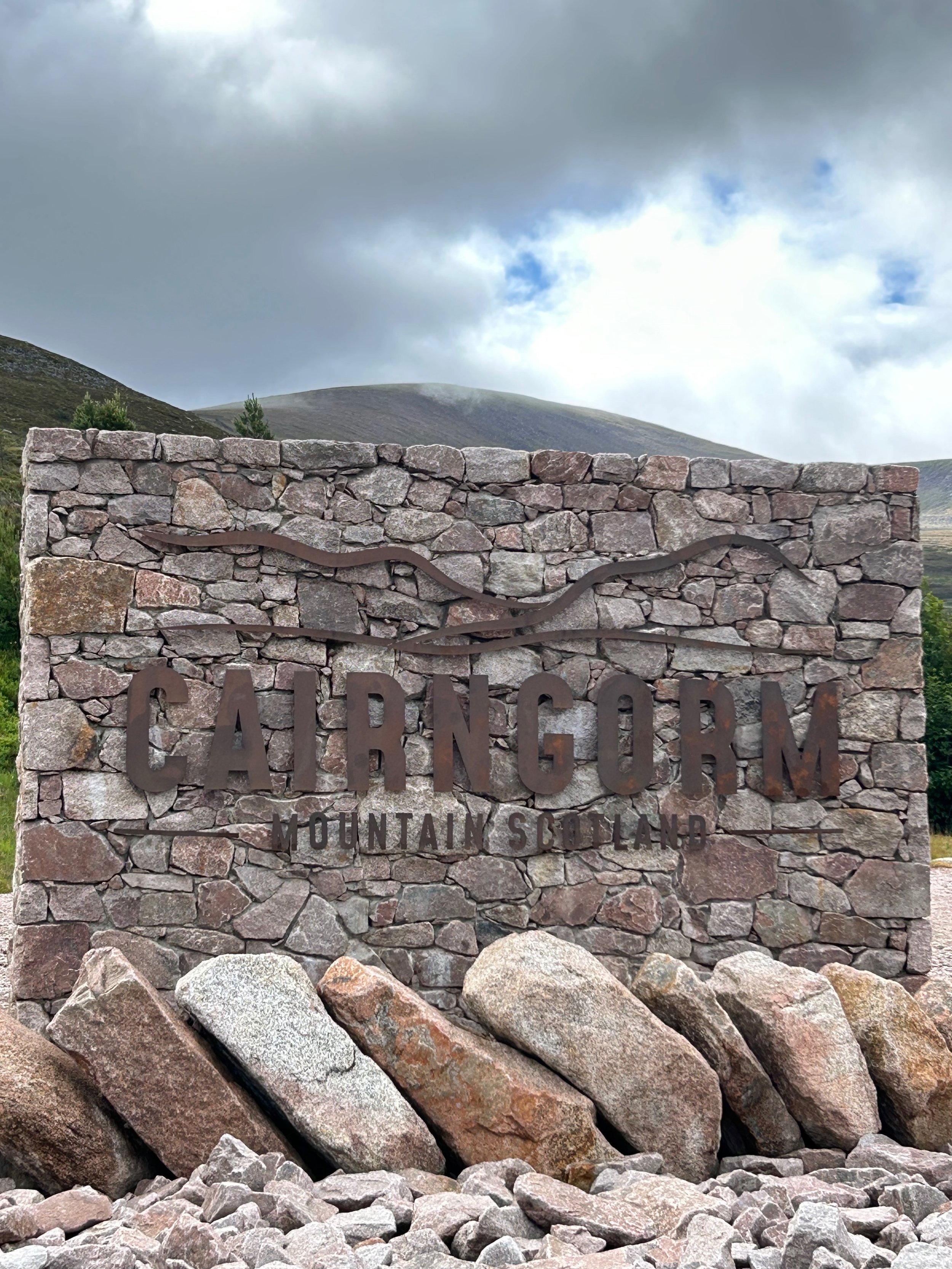
The Cairngorms is an awe inspiring mountain range, I recommend anyone to visit. What I loved most was the freedom to wild camp, so long as you were not on private land and respected the nature and environment with a “leave no trace” policy, you can camp. We don’t have that luxury in Germany, so I really appreciate this about Scotland. The Cairngorms, with mountains, rivers, lochs and forest brings such a variety of opportunities to enjoy the outdoors at its finest.
Blogs of my tours in June 2025:
-
After a first night in a campsite, I packed up my rucksack and headed into the wild for two days & nights. My plan was to hit the big Monroes in the area.
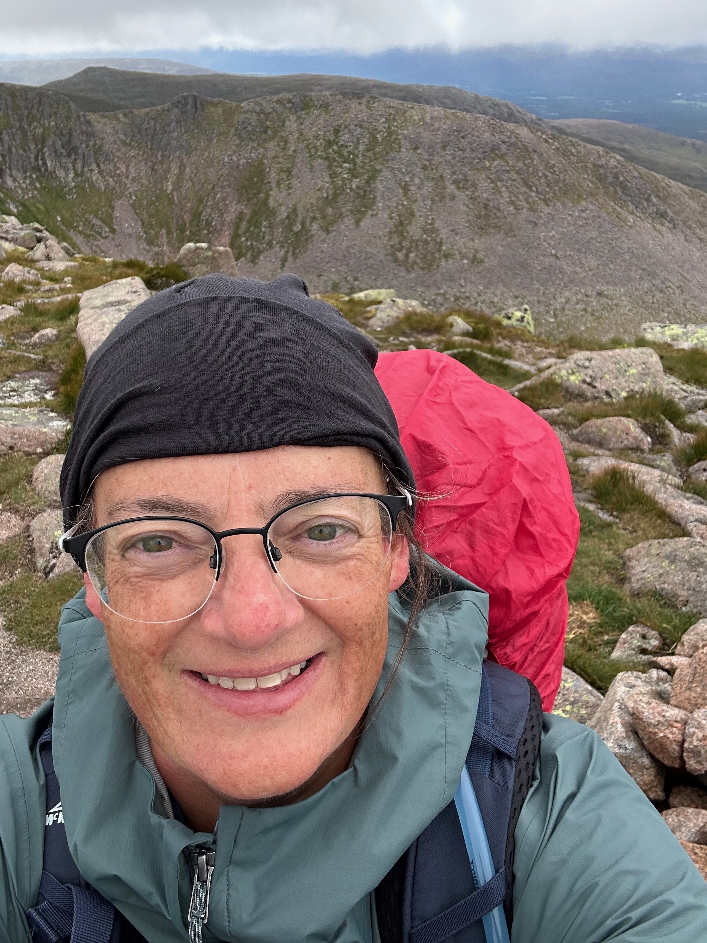
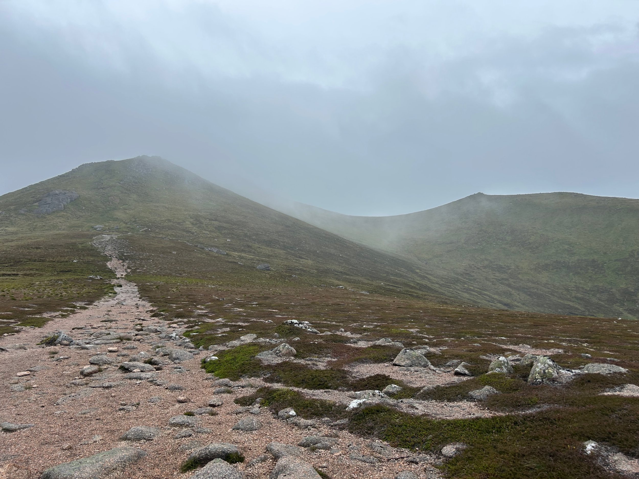
The weather on the first day was typical Scottish mountain weather – windy, wet and misty. Walking above the cloud-line for the much of the first day meant visibility was very poor and my glasses were wet and fogged up. At least I didn’t have the extra weight of my waterproofs in my rucksack. The first real climb coming out of the forest, led from the Cairn Gorm funicular railway base station and was aptly named Windy Ridge Path. Placed to fight against erosion from tourists, it was a man-made stairway into the clouds. Unfortunately, also a thigh burner for us height challenged folk.
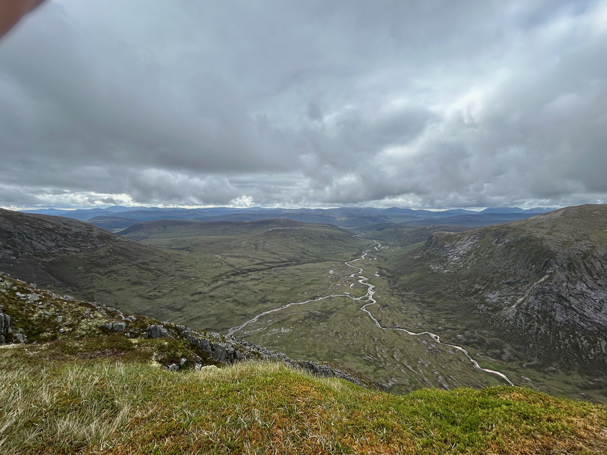
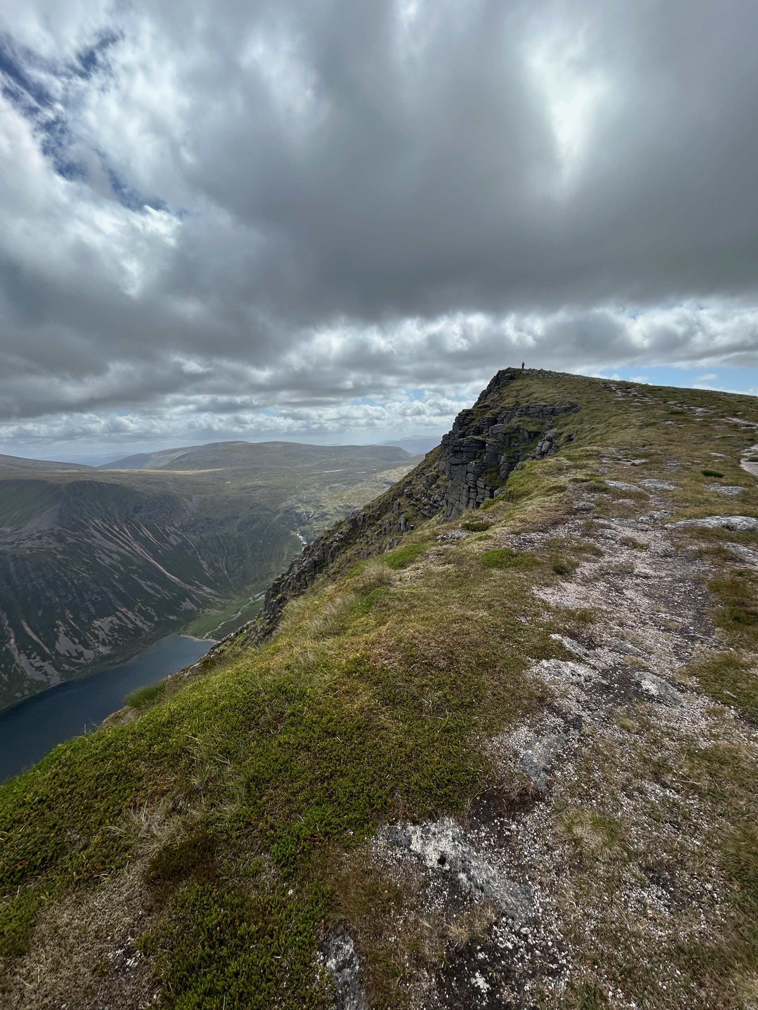
Dropping off Cairn Gorm, which stood at 1244m, the mist lifted for a short time to give me a stunning view down to Loch Avon, giving idea for another hike the next time I visit the area.
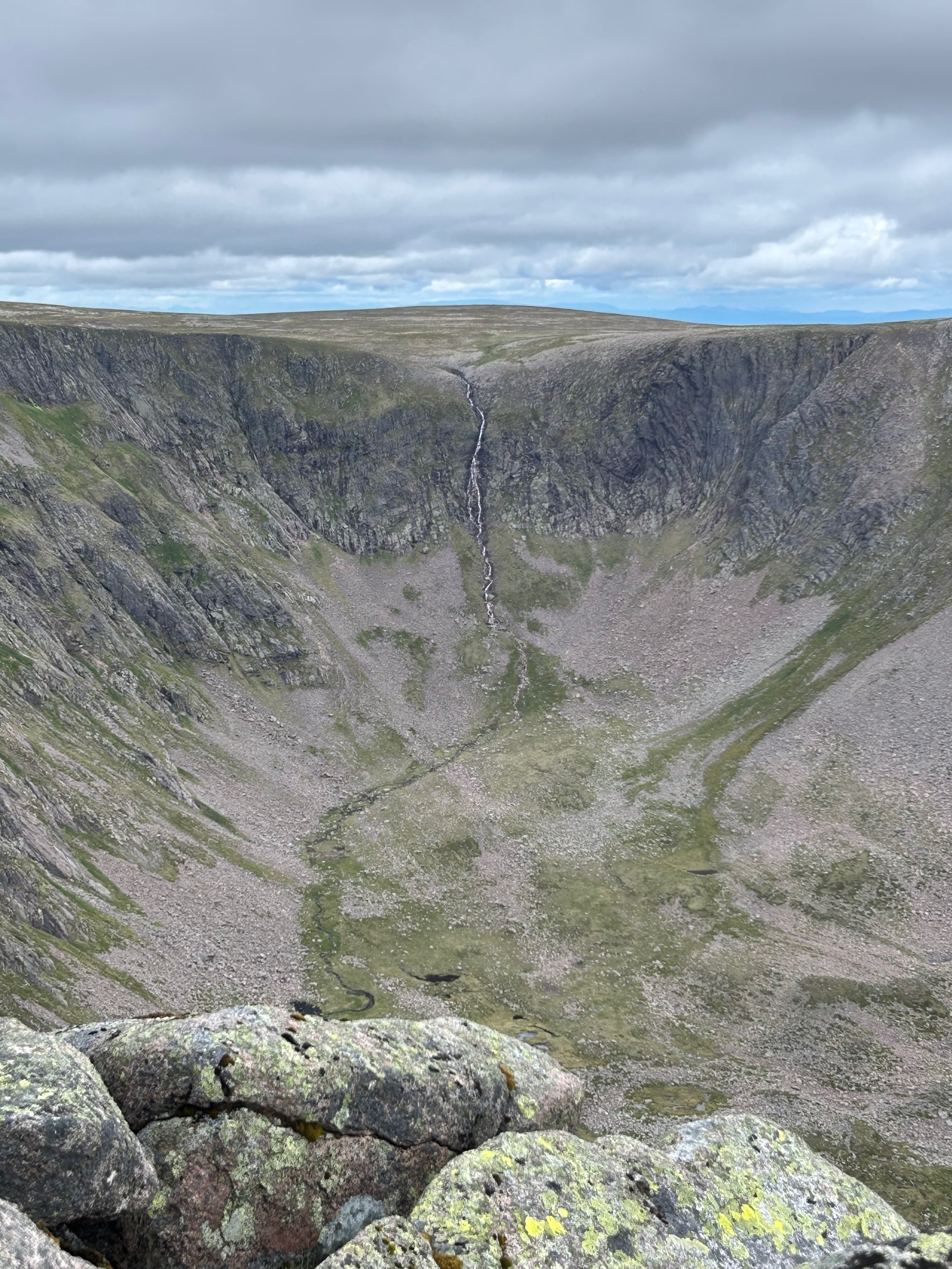
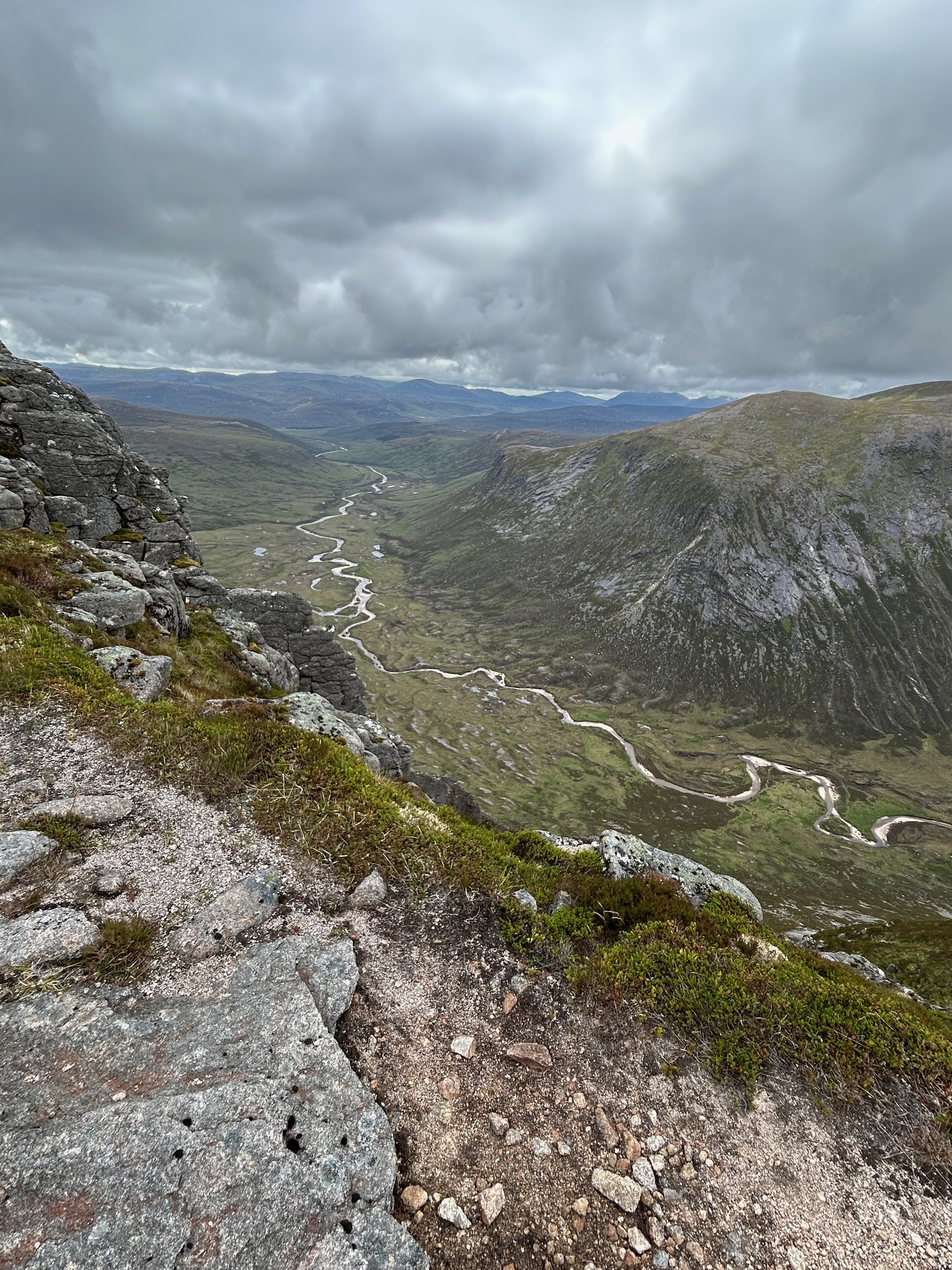
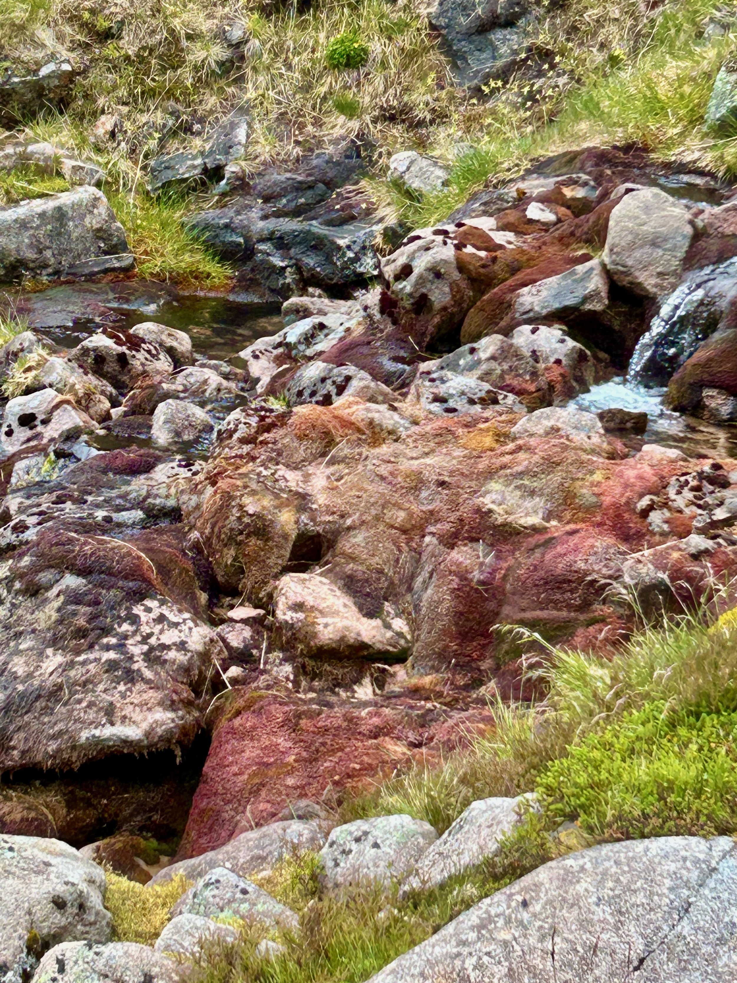
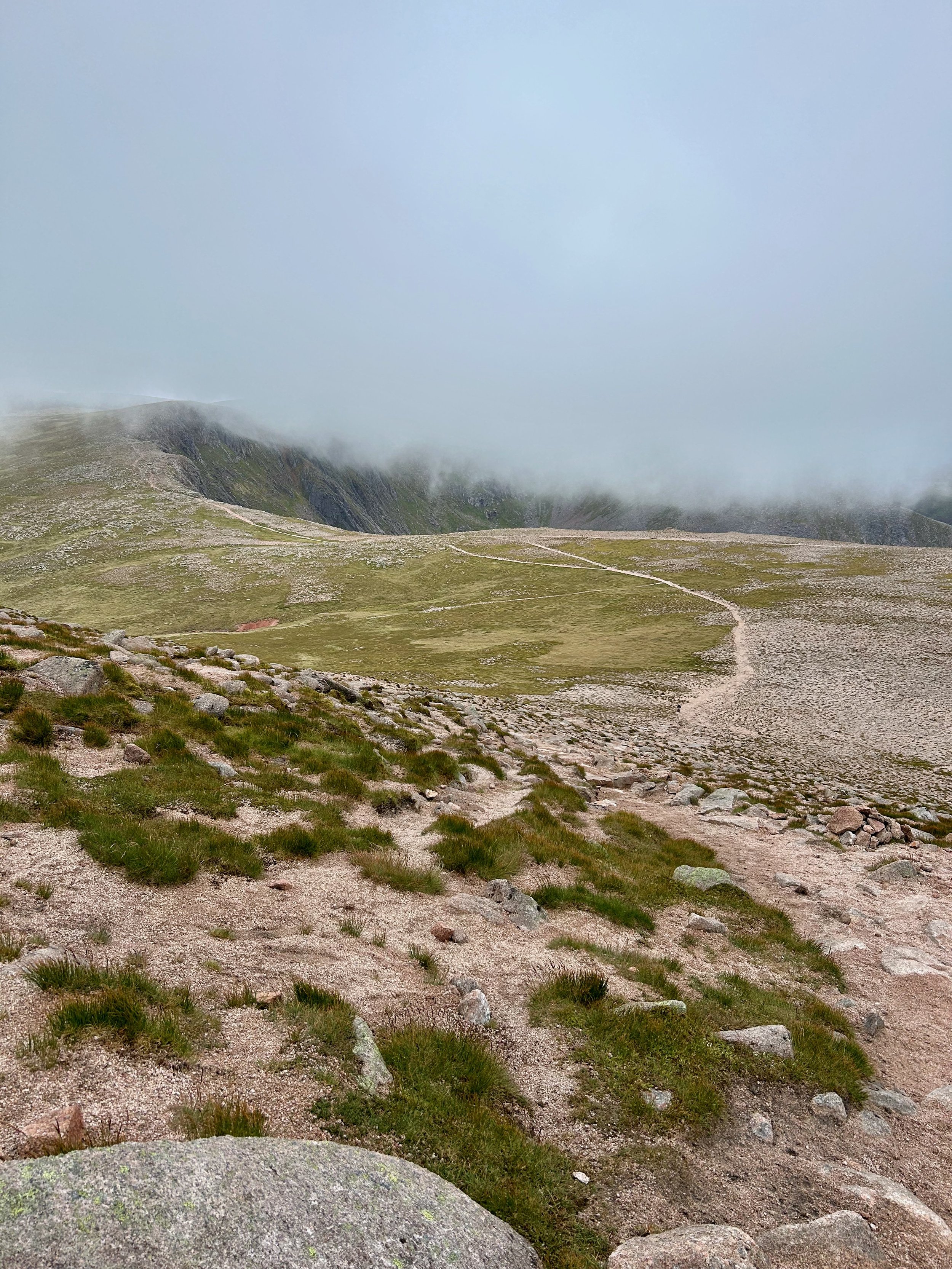
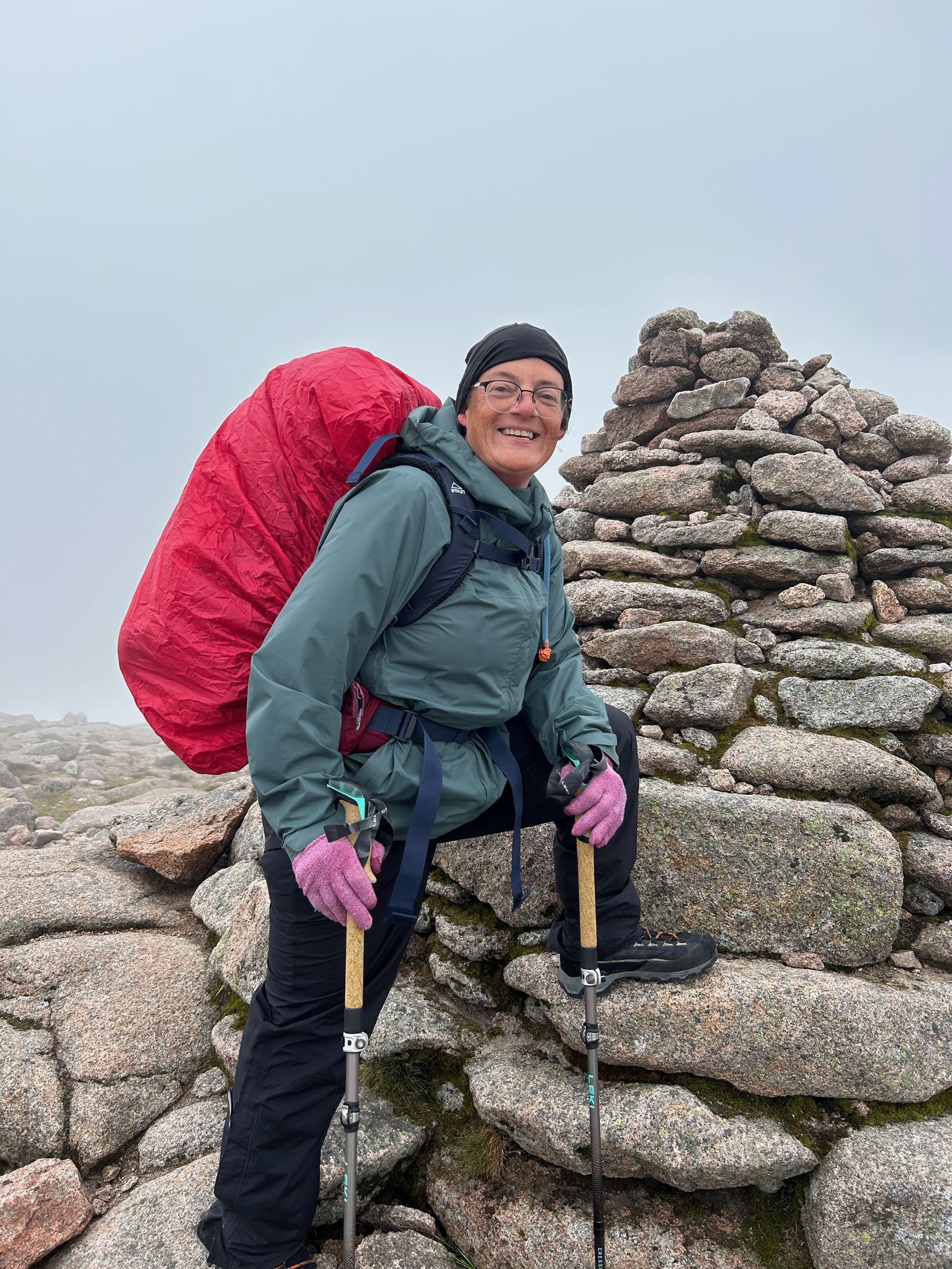
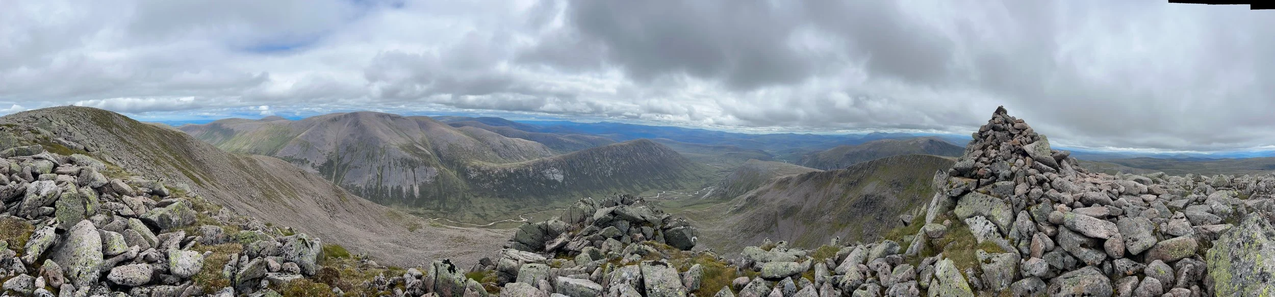
Heading up to the next peak, Stob Coire an t-Sneachda (1176m) I took a pause out of the wind to enjoy the moment, time for a snack and decided to take off the waterproof trousers due to internal overheating. This was a big mistake, as after the peak and climb up to the next, Cairn Lochan (1215m) and over the wide-open moorlands towards Ben Macdui, the heavens opened for real. Luckily there were large Cairns to help with navigation through the mist over the boulder field up to Ben Macdui, the tallest Munro in the Cairngorms at 1309m. My Last peak of the day, my challenge was to find a way down into the valley of Lairig Ghru to find a camp spot for the night. There was no defined route on the map, so I was hoping for a goat track I could follow that matched my planned decent. Relying on compass and map through the heavy mist and heading in a South Easterly direction, I found a small goat track, that lead to a very steep boulder section dropping into the Coire Clach man Taillear valley. Perfect, as the map indicated a track at the bottom section of the valley that I could aim for. Caution required, I carefully made my way through boulders and downwards sharply to the stream, which I then followed to the valley below. I was in awe at the stunning rainbow colours of moss in the stream, enhanced even more by the wet conditions. As a local told me later, this is why in Galic there are several words to describe the different shades of red. Stunning.
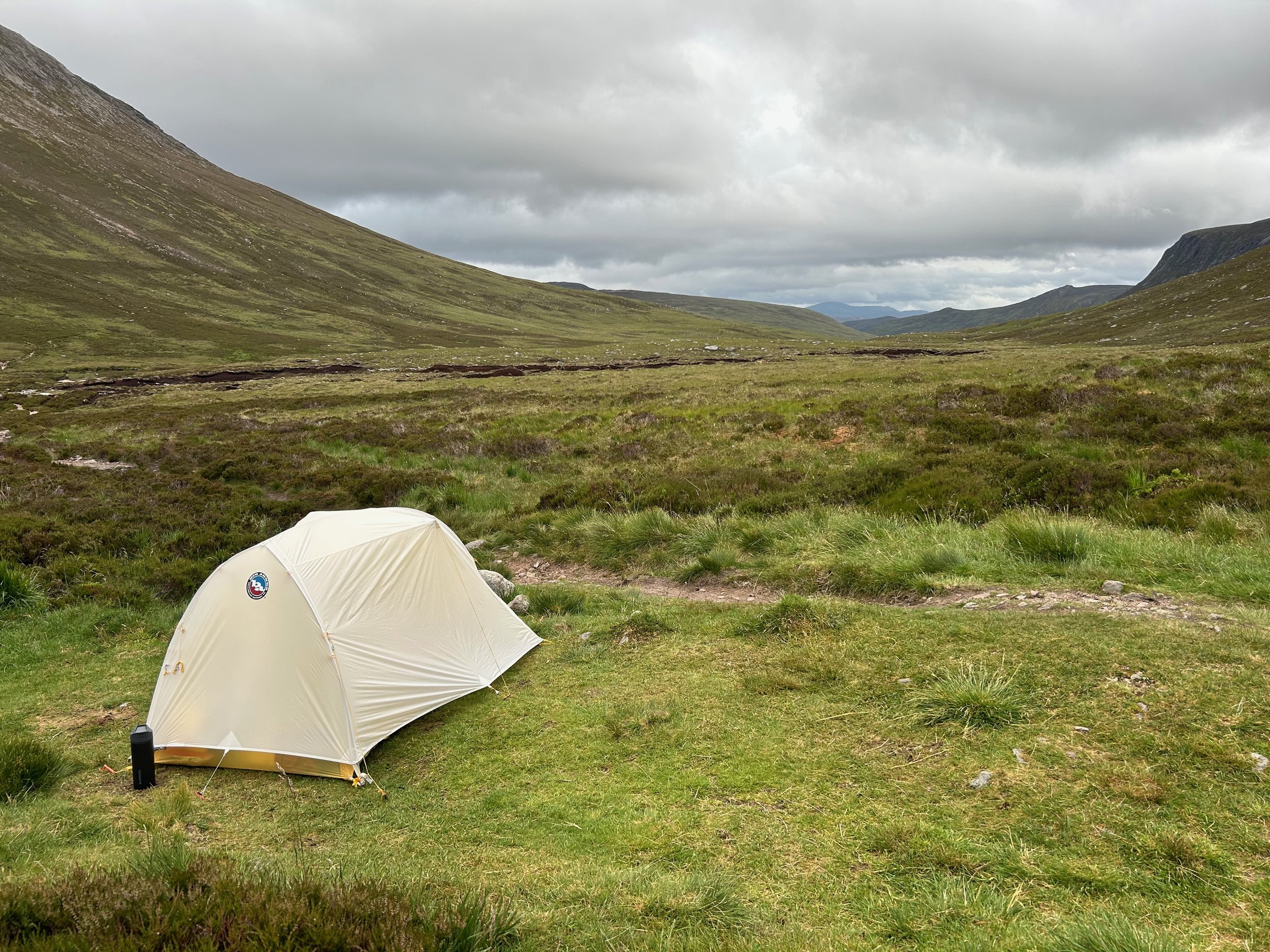
Feeling happy I’d made it to the Lairig Ghru valley after a great day’s hiking with tired legs and wet boots I strolled along the valley looking for a place to camp. As it turned out, there were not so many options available as underfoot was sodden peat-moor. I ended up pitching outside the bothy that stood at the foot of The Devils Point. An evening spent in the company of some lovely people.
The weather was much better the next day, visibility was great, the sun even made an appearance.
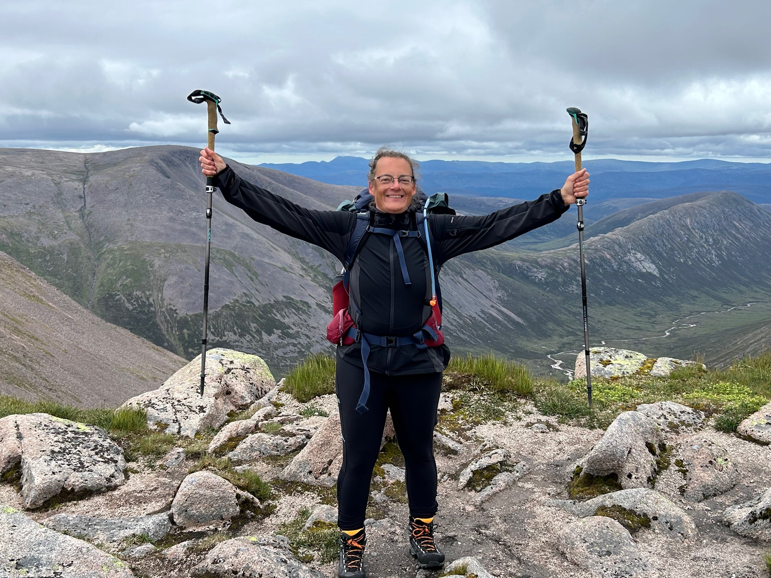
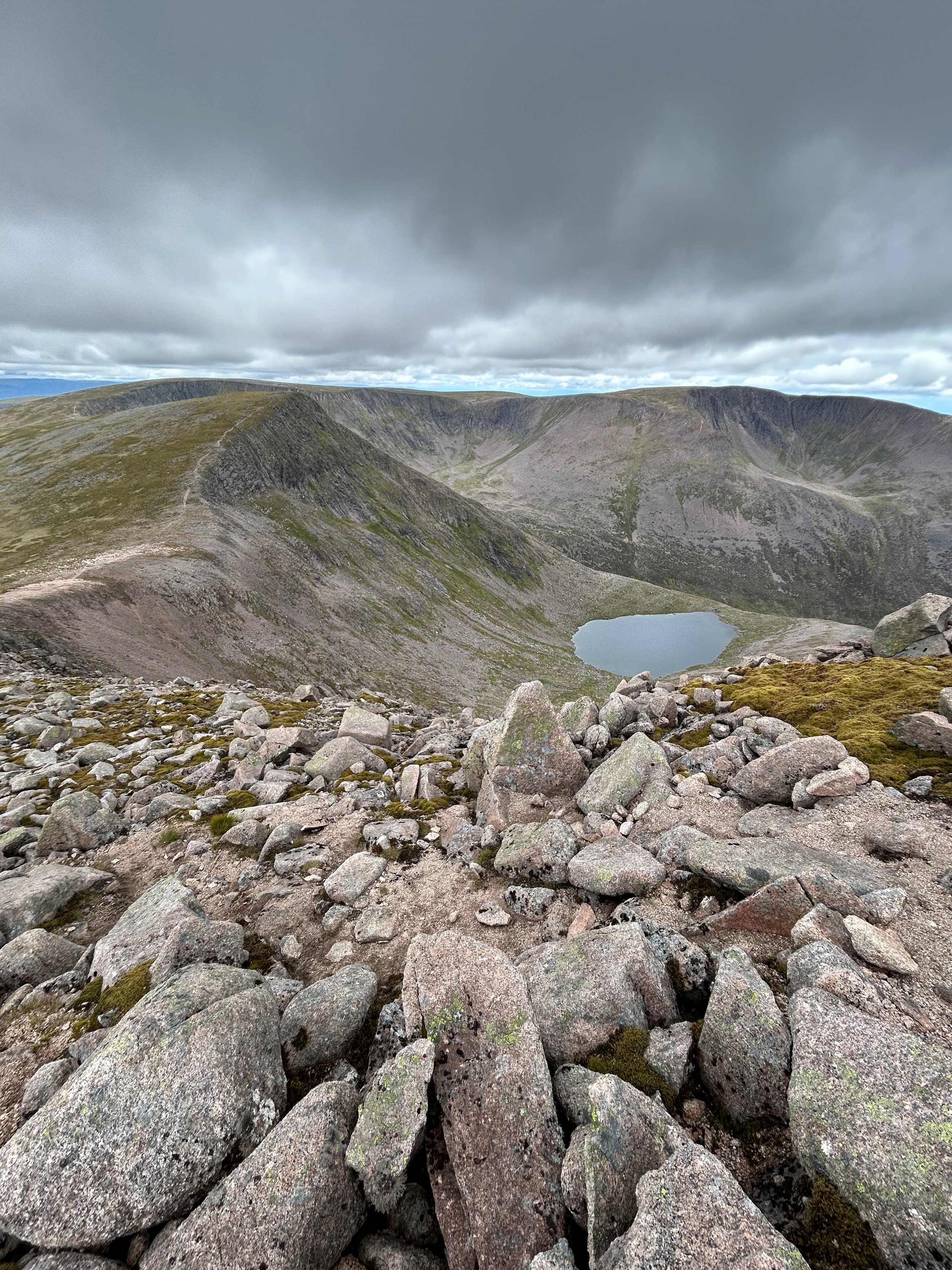
Putting my wet boots back on, I headed up to the Devils Point (1004m), leaving my rucksack at the col so I could nip up quickly, before retracing my steps as my route would take me in the opposite direction to Stob Coire an t-Saighdeir (1213m), which was a bit of a slog, and then on to Cairn Toul (1291m), which was my favourite of the day. The peak being covered with boulders, it is basically a big cairn to clamber over. I was very happy that it wasn’t raining and misty for this section.
Without too much elevation drop and gain, I made my way to the Sgòr an Lochain Uaine also known as The Angels Peak (1258m), before crossing the moor between Carn na Criche and Braeriach (1296m) the highest peak I would climb on this day. At Breariach, the wind picked up, along with many day hikers, to look at the wonderful views this peak offered. My last peak of the day Sròn na Lairige (1184m) was on my decent route back, another stairway not made for small legs), to the Lairig Ghru valley which I then followed back towards Glenmore to find a camp spot for the night. The shores of Loch Morlich offered me a perfect spot for the night to rest my aching legs. Sweet dreams.
Over 2 days I’d hiked 58km, took over 82,000 steps and gained 2,527m elevation.
-
After a two-day hike with a large rucksack loaded with tent etc, it was to be a relaxing start to day 3. After a leisurely breakfast of beans sitting watching the ducks on the loch, I made my way to Glenmore campsite where I’d booked in for 2 nights, set up camp, had a shower and took a trip to Aviemore for an amble around a few outdoor shops and a second breakfast. The “Green Folder” and the campsite team together helped me come up with my plan for the days’ hike. Switching to a day pack, I headed back out onto the trail in the early afternoon. It is light until late in June with only 4 hours of darkness, so I could still get a full days’ hike in.
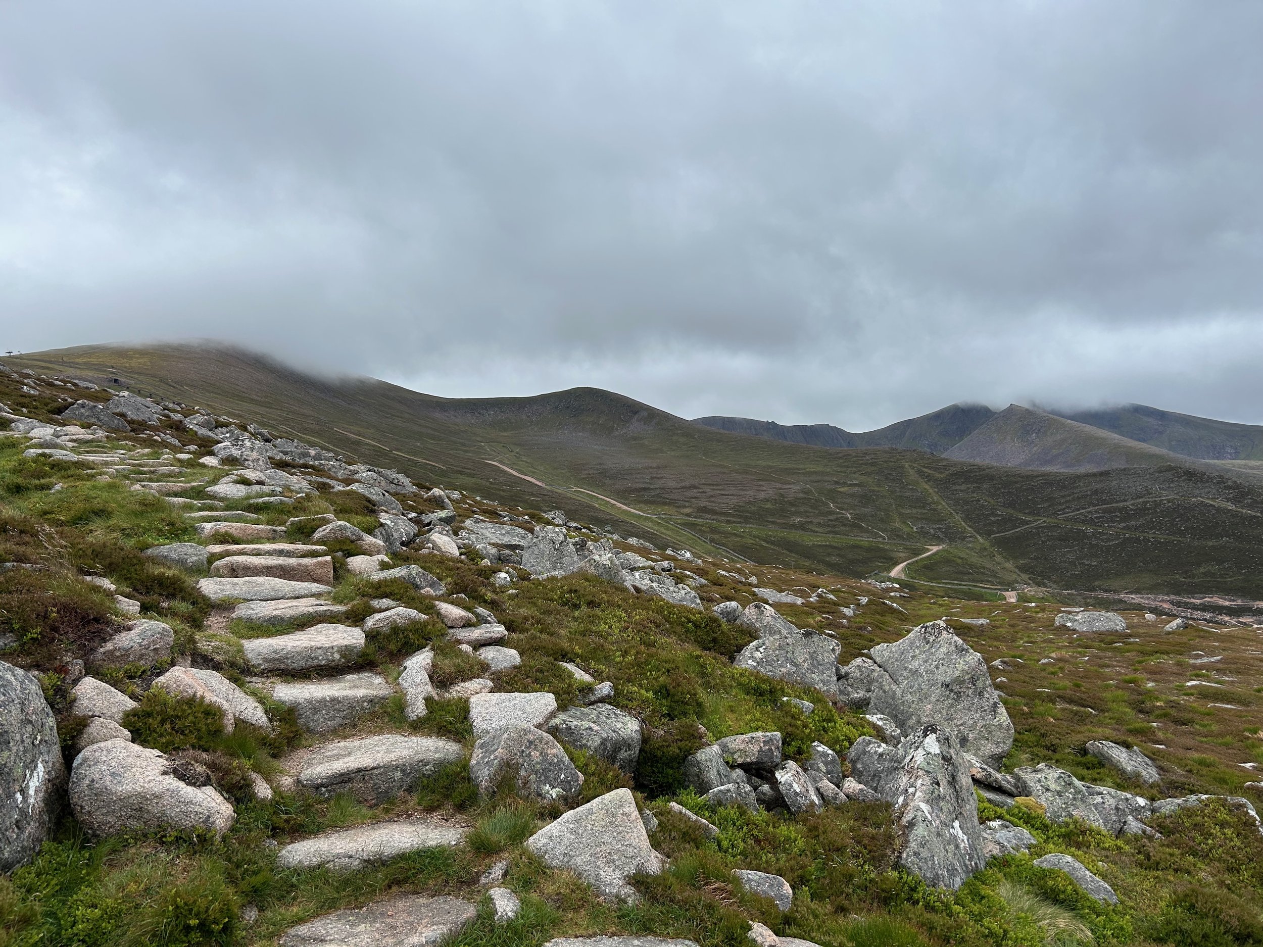
My route headed west along the old logging path alongside the loch & road, before turning north into the forest to the Badaguish Outdoor Center and onwards and upwards to the edge of the forest and the foot of Craiggowrie at 687m. Only a 350m climb from the campsite’s elevation, but the path didn’t mess about – straight up. And from this point comes the challenge for the day – Wind! Luckily a tailwind on the way up but gradually increasing in intensity the higher I rose. Donning a windproof layer at the top, I couldn’t stand and enjoy the view for long due to the wind. I continued along the ridge path, first to Creag Chaillich (711m), then on to Creagan Carn (732m) and finally Meall a Bhuachaille at 810m, the last climb was 186m straight upwards, no messing about and no levelling to grab a quick pause. The highest peak for the day, Meall a Bhuachaille is not a Munro, but not bad for a ‘rest day’. And during the whole ridge walk, the gale force gusts up to 50mph were enough to blow you off your feet if not careful making the hike seem harder than it was.
I was able to sit behind the peak cairn for a short break from the wind to catch my breath before heading down. The path down was gentler and away from the wind a bit.
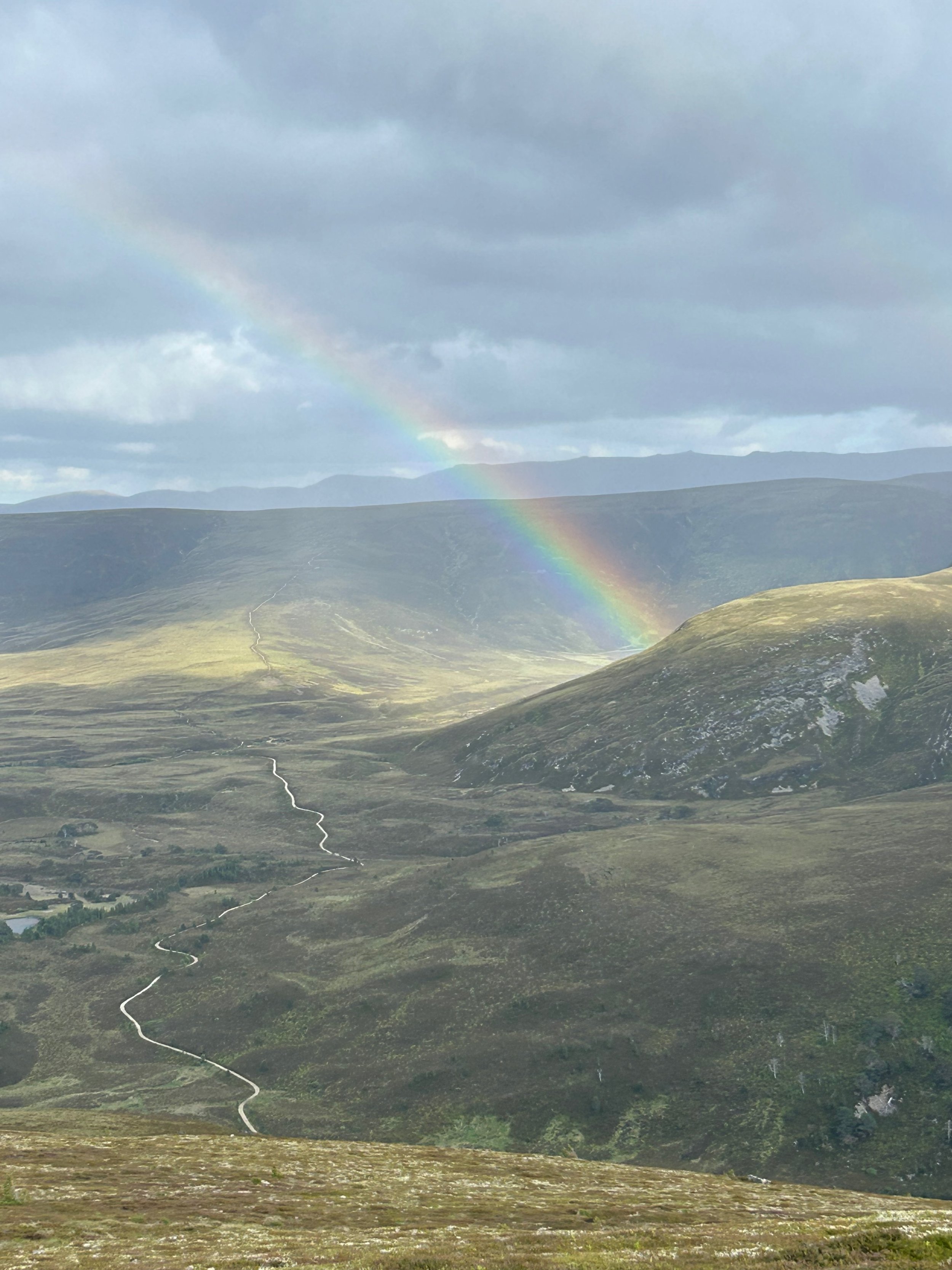
I saw two young guys (first people seen on the hill that day) who had left their backpacks at the Bothy & were hiking up quickly to earn their supper. They had the good fortune that several wild hares closely ran across their path. I could see them too, but was unfortunately too far away. A short rain shower also produced a full arching rainbow for a timely photo as we were chatting.
I took a chillout break at the Bothy to eat my lunch, while chatting to a few guys from Ireland setting up camp outside the Bothy.
The path down along the Ryvon Valley was easy going and went past the picturesque Loch Uaine, also known as the Green or Emerald Loch. A small popular loch, with several tents pitched ready for the night, it had potential for swimming – I must remember to pack my towel. Continuing, the path past the Glenmore National Outdoor Centre & eventually the Glenmore Reindeer Centre (I didn’t see any), before arriving back at the campsite. Unfortunately, the local bar was closed that evening.
-
Brynack More can be reached from the Glenmore Campsite. The route retraces the path up the Ryvon Valley, passing the Emerald Loch before taking the righthand path at the split and continuing to the river Nethy. This spot by the river and the small bridge crossing, looks like a great place to camp if there is no space at the Ryvon Bothy as there is a clearing of flat grassland, which is rare on the moors.
After crossing the river the elevation increased slightly, along with the wind gusts which made progress slow over the moor. Visibility on the moor was increasingly worsening and I was surprised when two people appeared in front of me out of nowhere. Apparently the steeper climb to the peak would appear soon, I’d have some respite from the wind on the initial climb, and then the gale force gusts would beging. They weren’t joking. They also warned me to not be fooled by craggy sections looking like the peak cairn. As you get to one, you’ll see the next path continuing through the mist, the ridge just keeps going they said. I was so thankful for this heads up as I could prepare my state of mind to not celebrate too early avoiding any disappointment.
The heavy rain really started as I started the steep ascent from the moor, great. Thankful that I had a good signal, I could use my mobile to find my exact location on the map using GPS, instead of using my compass which would inevitably have slowed my progress in the rain and mist.
With Gale force gusts, it wasn’t a day for sitting around, enjoying the view and taking a lunch break on the peak. Instead, quickly touch Cairn, shout YAY, turn around and quickly and carefully retrace path back down out of the wind.
Back down at the river crossing, the clouds had dispersed and the sun made a showing so that I could enjoy a late lunch and put away the waterproofs. I’d also packed a lightweight packtowel, so continued on to the emerald loch to enjoy a swim. Yes the water was chilly, but I also had the good fortune that for a short time, I had complete solitude for my swim in this beautiful touristic location. A perfect moment to reflect on the day’s adventure, the natural beauty of where I was and how lucky I am.
For the return to Glenmore, I spontaneously took a narrow path off to the right and decided to explore as it wasn’t on my maps. it headed through the marsh close by the loch, wooden walkway in part, before heading upwards through the trees and connecting finally to a wide forest track, that was on the map, that led down to Glenmore by the reindeer centre. Although adding completely unnecessary elevation my day, it felt a more fun and adventurous alternative to the wide forest path in the valley.
Live music, beer and burger in The Pine Marten Bar, Perfect end to a perfect day in the hills.
-
After packing up camp & saying goodbye to the friendly staff at Glenmore campsite, I headed towards Aviemore. At Inverdrui I turned left onto the B970, and continued past the Feshiebridge and parked at the walkers carpark (Free) just north of Achlean.
Day pack on, I headed towards Achaean, taking the marked path to the left that skirts around the hamlet. Ahead the path splits, the right way heading along the river Feshie, the left heading through the forest and up into the moors. My planned route is the later, which provides sun shade and protection from the wind but immediately starts climbing towards the moors of Badenoch.
The weather forecast is windy with gusts up to 50mph (80kph) on high ground and peaks. One of the ladies in the campsite reception advised against my planned hike “A particularly windy summit on a good day, not advised in today’s winds. Be careful!”. This comment had prepared me. The winds started as soon as I left the trees and gradually increased as I progressed up the path that followed the Allt Fhearnagan stream up to it’s source.
Turning northwards at this point the path leads onto the first high point of the day, Càrn Ban Mòr (1052). Wow, the wind & gusts were impressive on the open Moors. A rock circle providing shelter to a couple that looked a bit battered and miserable after their decent from the peaks, not even in the mood to say hello. I walked on.
A small decline down to 1012m before climbing up to Sgòr Gaoith at 1118m. Here there was no let-up in the wind, whipping from all directions, especially up the face from Loch Eanaich.
There were rock slabs at the edge which I lay down on, sheltering a little to peer down over the edge to the loch.Great views.
Before taking the last meters up to the peak, you can bear slightly right and hide under the Peak slabs, also providing shelter to enjoy the views downwards and along the valley.
I continued along the path, dipping down slightly again to 1053m before the final 60m climb up to Sgòran Dubh Mòr at 1111m.
The wind was relentless, and even though there were potential rocks to provide shelter on this peak, I had no rest-bite as the wind was circling up and around the rocks. I chose the best spot possible to have a lunch break.
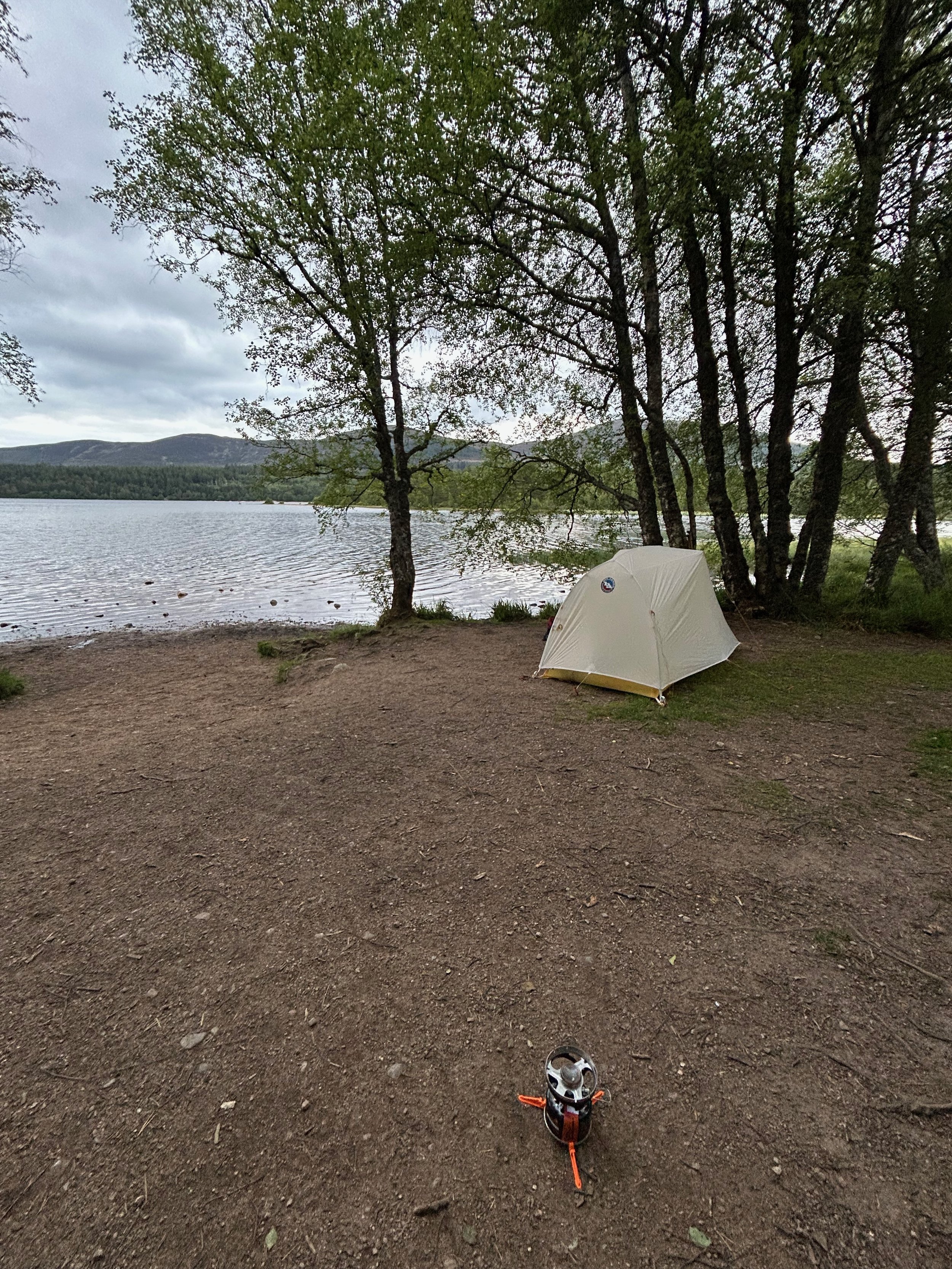
My route down on this day, was to retrace my steps back down to the forest. My map had indicted a bothy in the forest by the waterfall, but I searched without success. Instead I headed back tot he carpark, switched to my overnight rucksack with tent, and headed along the river (about an hour) to find a nice spot for the night. And oh boy did I find the perfect place. Coming away from the main path, I came across a small path through the shrubs heading towards the river that I decided to explore. It dropped down away from view and a small clearing of bush allowed for 1-3 tents by the trees.
Camp coordinates: 57.03239, 3.89816, Grid ref NN 8495 95080).
I wasn’t the first to discover this gem, as there was a a used fire pit at the opening to the river. I didn’t spark up due to the dryness and fire risk, but happily got out my Jetboil and enjoyed my dinner in a perfect setting to end my Cairngorm adventure week. I’d found my happy place!